Reported Earthquakes: Week of Nov 2–Nov 8, 2026
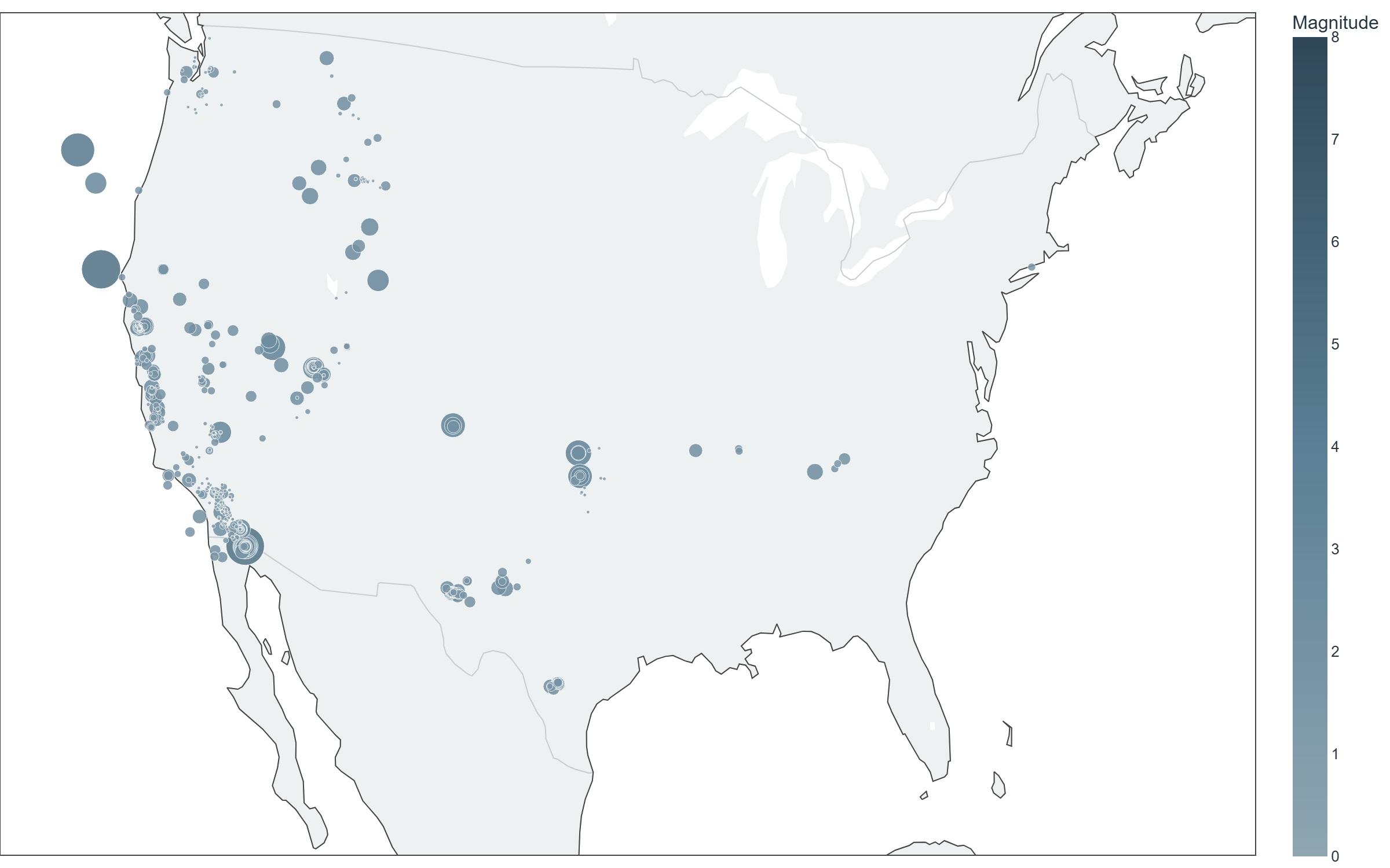
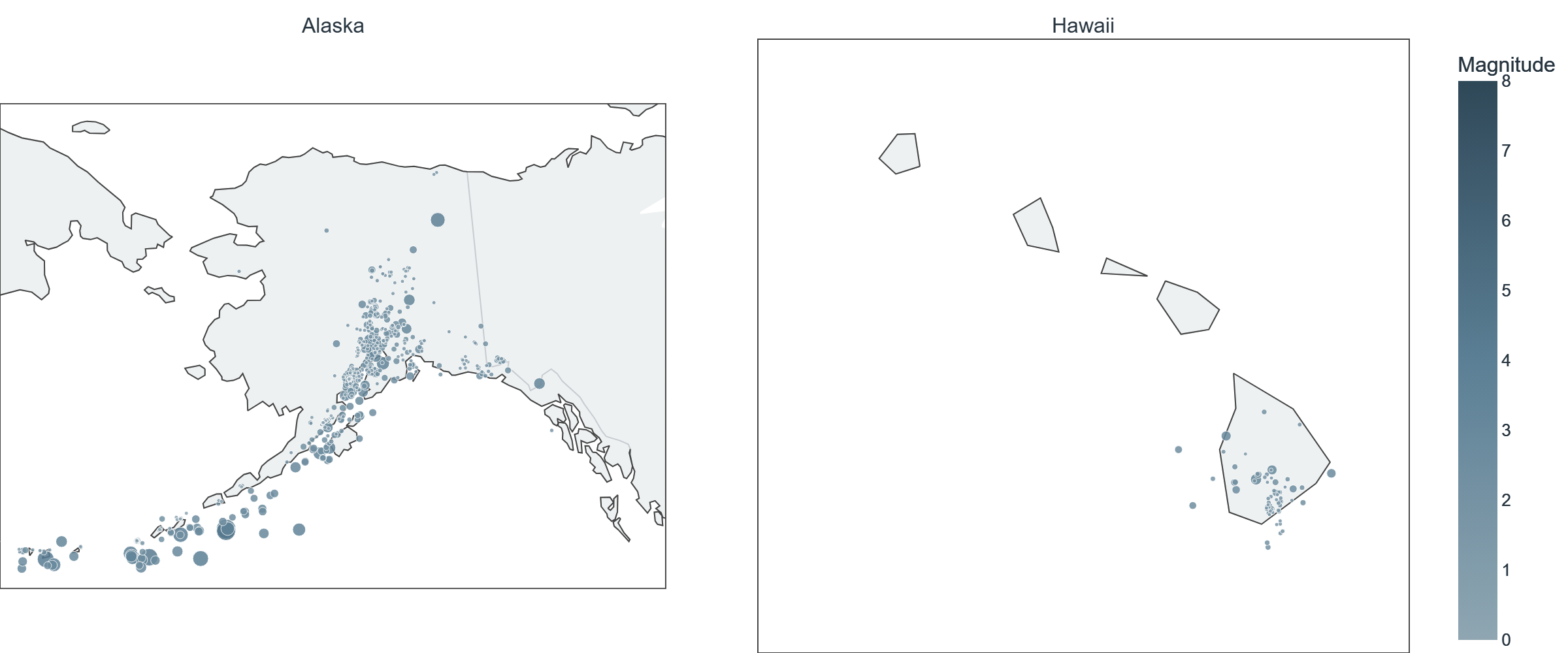
Every reported earthquake is shown, sized and colored by magnitude on a fixed scale (consistent week to week). Alaska and Hawaii are shown at their own scale — see the note below on why.
USGS-monitored sensors recorded 1643 reported earthquakes across the United States and its territories for the week of November 2 to November 8, 2026, including 178 at magnitude 2.5 or greater. The largest, a magnitude 5.0 event, was recorded near 111 km W of Petrolia, CA on November 5 (04:56 UTC).
State & territory breakdown
| State/territory | Reported | Largest magnitude |
|---|---|---|
| Alaska | 585 | M4.7 |
| California | 545 | M5.0 |
| Utah | 152 | M3.1 |
| Hawaii | 74 | M3.1 |
| Texas | 42 | M2.5 |
| Unresolved (CONUS) | 40 | M4.9 |
| Puerto Rico | 40 | M3.6 |
| Washington | 34 | M2.2 |
| Oklahoma | 31 | M3.6 |
| Montana | 26 | M2.4 |
| New Mexico | 24 | M2.5 |
| Nevada | 17 | M3.5 |
| Idaho | 9 | M2.6 |
| U.S. Virgin Islands | 6 | M3.4 |
| Tennessee | 6 | M2.5 |
| Wyoming | 4 | M3.1 |
| Oregon | 3 | M4.4 |
| Colorado | 3 | M3.4 |
| Arkansas | 1 | M2.2 |
| Connecticut | 1 | M1.6 |
Source: USGS Earthquake Hazards Program (public data). Magnitude 2.5+ is shown on the map as a readable threshold; the total above includes all magnitudes USGS recorded for the week. Reported activity reflects what instruments recorded — it is not a judgment about risk to any specific place. Full unfiltered catalog: USGS Earthquake Map.
Download Consilium
See regional safety signals for your neighborhood in the Consilium app.
